A 2-3 day hike on Airlie Beach’s doorstep
The Whitsundays, a destination usually associated with the aquamarine waters that ebb and flow around its 74 islands, is popular with tourists who line up for boat tours and reef days spent sailing, paddling, snorkelling and connected to all things blue.
It’s July and I’ve come to Airlie Beach not to sink beneath the blue, but to dive amongst the green.
Leaving behind the frosty winter mornings of my home in NSW, the idea of wandering through Conway National Park, the traditional lands of the Ngaro and Gia peoples, where daily temps were sitting around 22c, was a seasonal no-brainer.
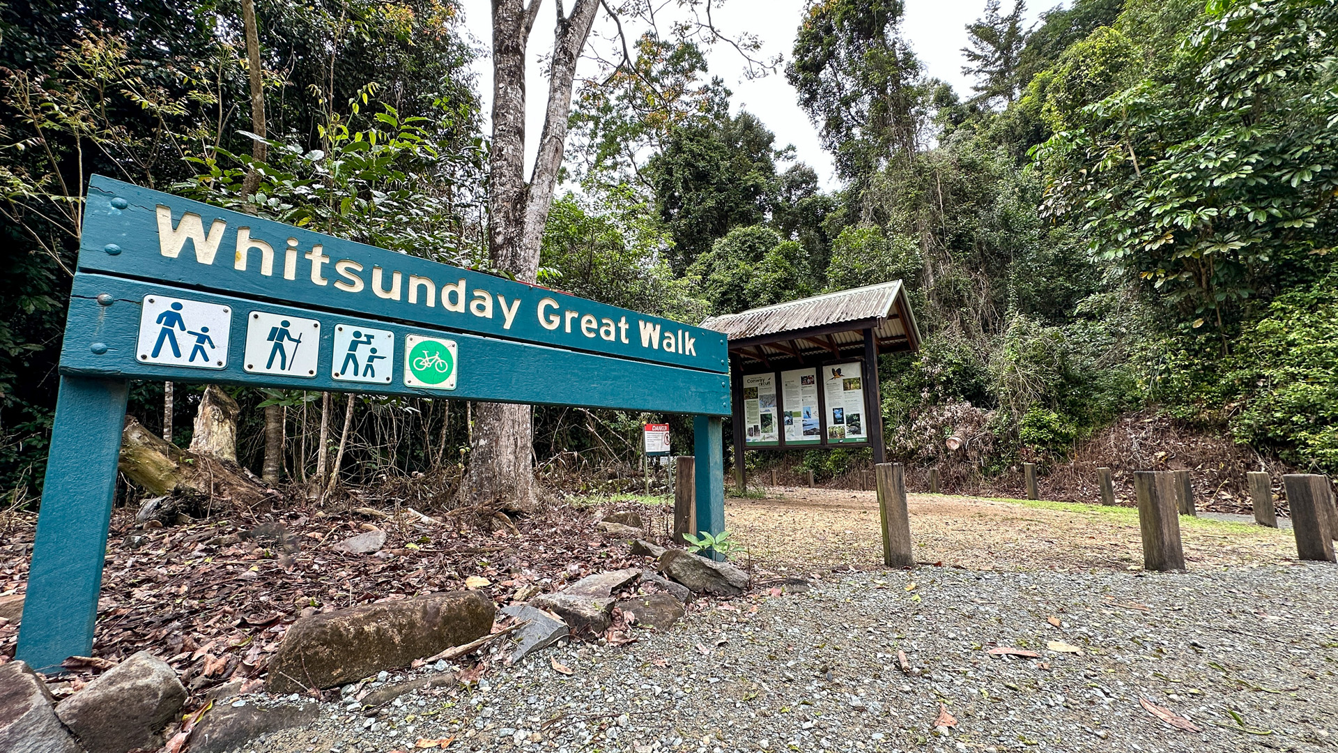
Unlike most multi-day walks I do, I chose not to spend hours researching other people’s trips or falling down rabbit holes of personal opinion. Rather than going with answers, I wanted to go with questions: Why doesn’t the Conway Circuit, a 27 km track, billed as a 3-day walk, not fill many popular Instagram or social media feeds? Why was its name changed from ‘Whitsundays Great Walk’?
And, why (for the dear love of the hiking gods), is it called Circuit? ‘Cos no matter which way I look at it, this track ain’t anywhere near a loop!
The air is glowing with golden afternoon light, amplified by the sugar cane fields along the 35-minute drive from Proserpine Airport to Airlie Beach. I’m struggling to keep my eyes on the road as I’m constantly drawn to gaze on the spurs and ridges dressed in rainforest coats that lead away to the coast.
‘Ooo! Is that the Conway Circuit?’, I wonder in excitement. My lack of research unwraps my first surprise, followed by the next – there’s no Uber in Airlie.
Day 1 – Brandy Creek Road to Repulse Creek Camp (8km)
The following day I’m dropped at the start by the local version of Uber (NeedaRideWhitsundays.com) and my driver quickly turns the conversation to her favourite subject, snakes. Another surprise! There are 70 different reptiles in Conway National Park. Good to know most are skinks, lizards and turtles… and just a few snakes (I didn’t meet any).
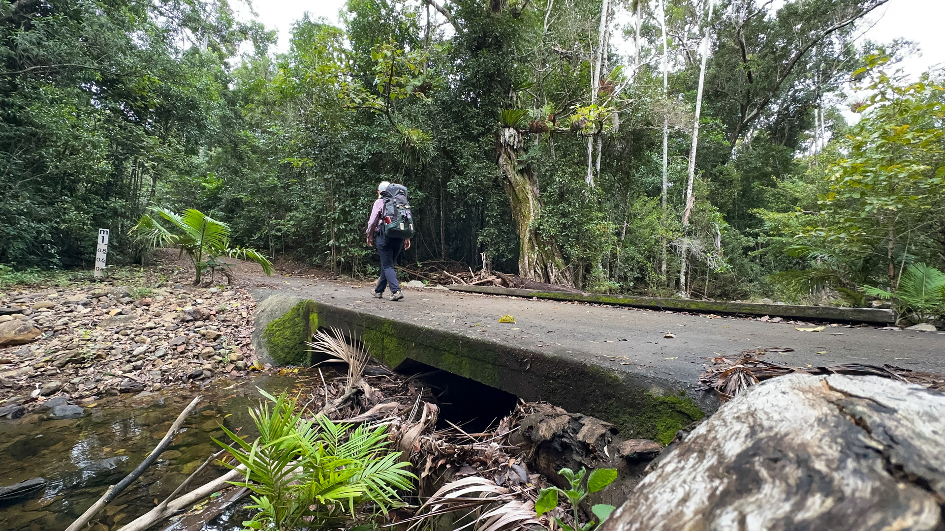
The carpark at the end of Brandy Creek Road is at the top of a winding Forestry road and delivers me at 230 metres above sea level – the highest point for the day. All that is ahead of me is a very leisurely 150 vertical descent over 8 km to the first campsite at Repulse Creek Camp.

Ten steps along the track and the call of the Wompoo Pigeon breaks the gentle silence. Their delicate call will be my private DJ for the next two days, mingled with a few other bush noises, but more on those later.
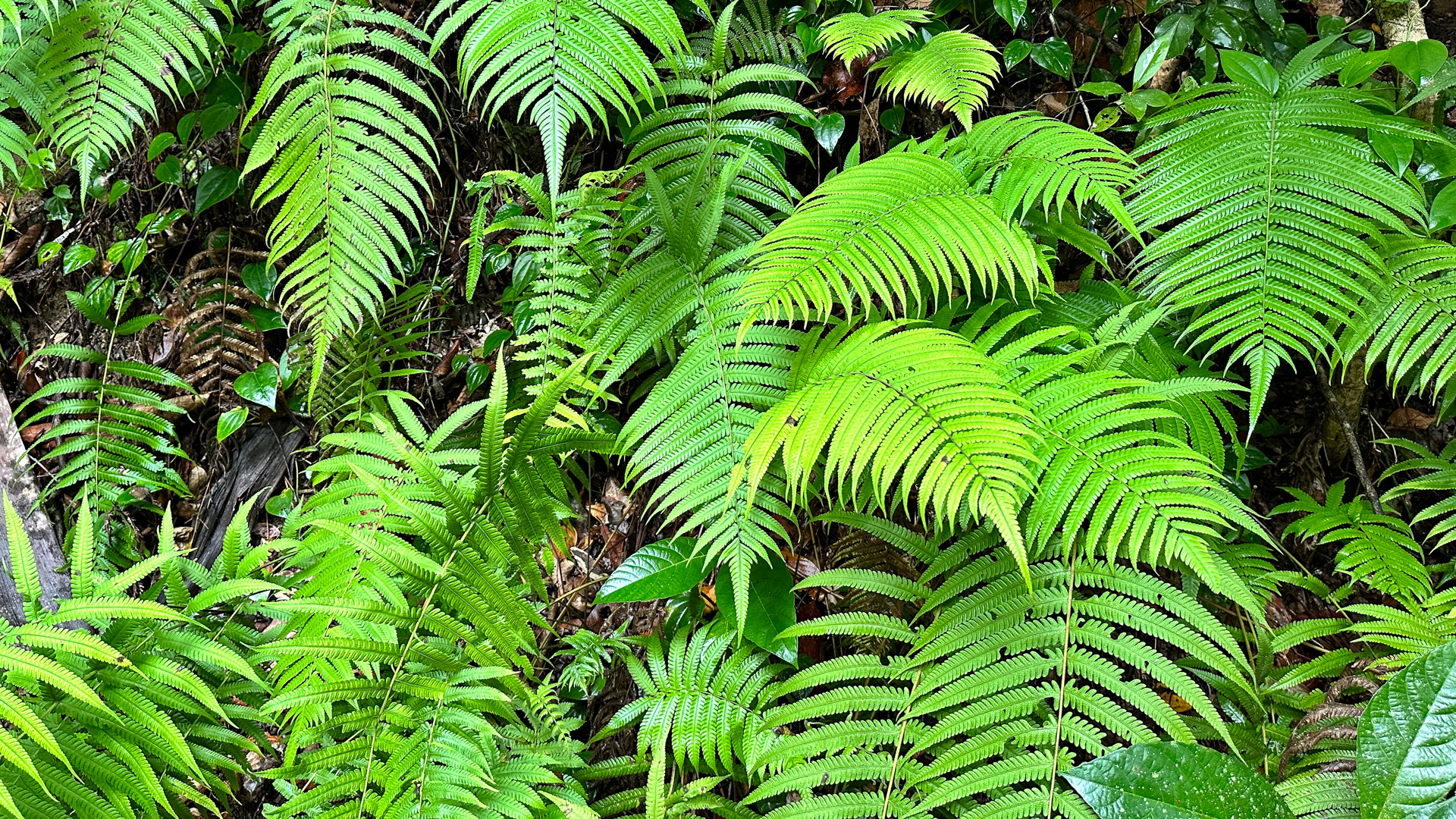
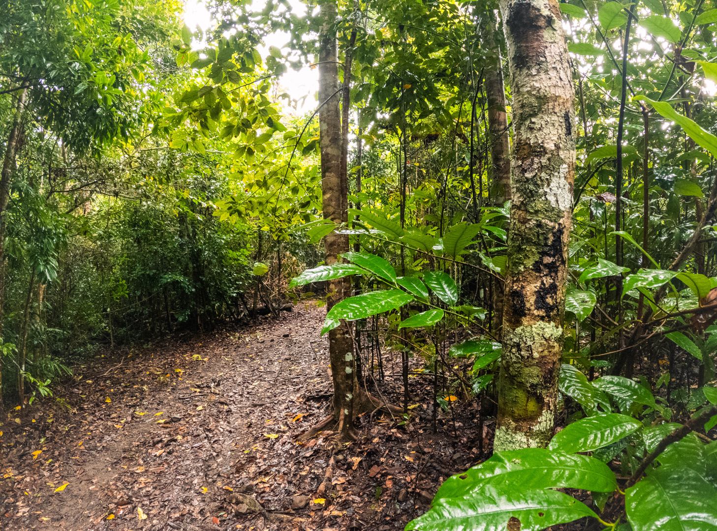
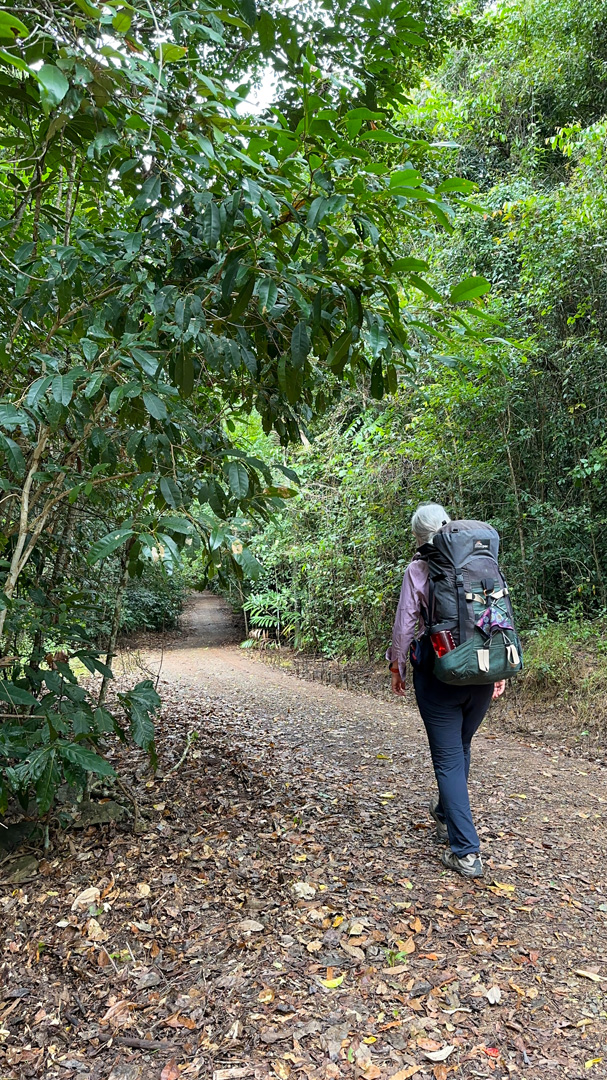
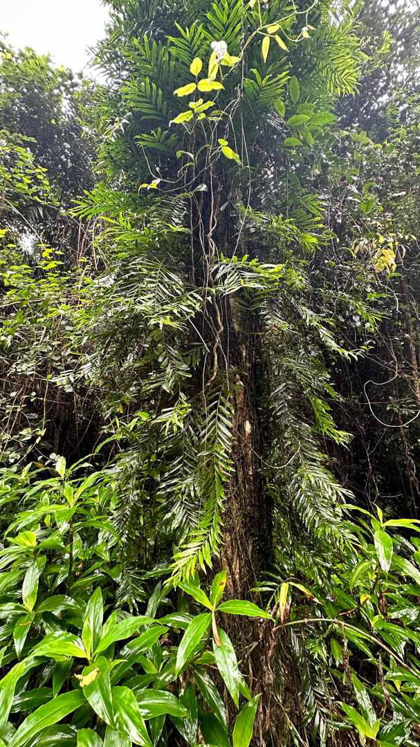
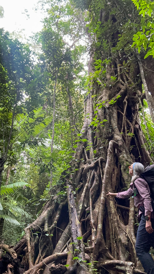
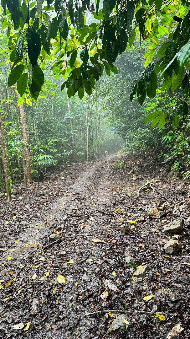
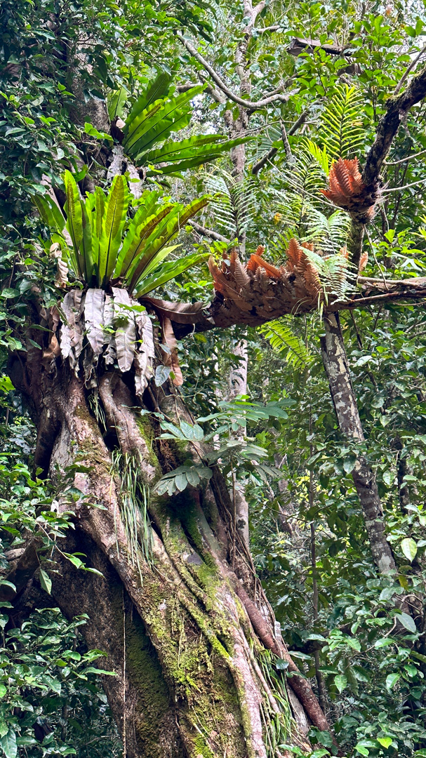
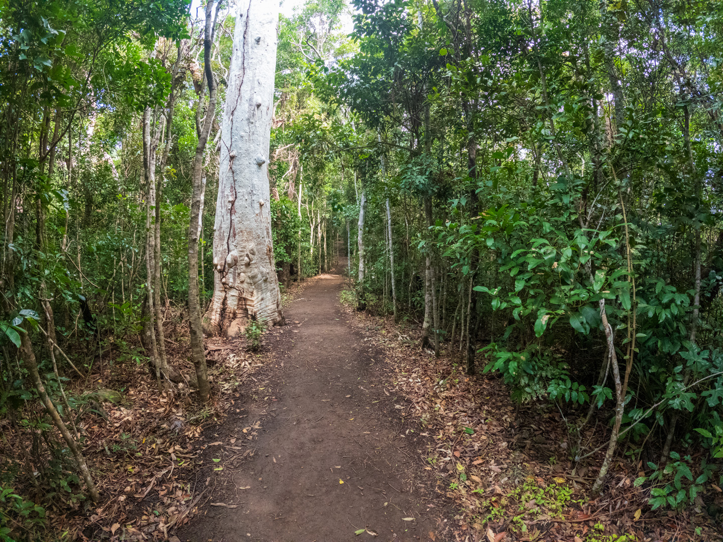
Underfoot, the stable two-wheel drive gravel bed makes for some of the easiest walking I’ve ever encountered whilst on a multi-day track. The rainforest walls on either side of this former logging track reach forward forming a verdant tunnel, while giant tree ferns stand like towering sentinels, competing for sunlight above the dark, multi-layered canopy.
I walk with my head resting back on my pack, allowing my gaze to be held by the pockets of silver sky above. Last night’s leftover rain drips onto my face; it seems only right and pure that I feel the rainforest with all my senses.
Four kilometres along, as I’m feeling the strong lullaby of easy walking’s simple rhythm, I shake myself out of the soporific samey-samey haze and need to remind myself – this is work. I should be looking for camera angles and shots that best tell the story of this track.
Everywhere I look, I just see green. One million shades of green.
No editor will be impressed (let alone the astute Great Walks readership!) if I submit 20 images, variably described as ‘Rainforest – Conway Circuit’.
I start to wonder: if this hunger for the new or different is what fast-changing multiple-tabs, incessant swiping and doom-scrolling, have been surreptitiously teaching us. Leading us to believe that what is constant, what is the same, may not only be what some call, ‘boring’, but perhaps not ‘Great.’?
Is this why the Conway Circuit, formerly known as the Whitsunday’s Great Walk, had a name change?
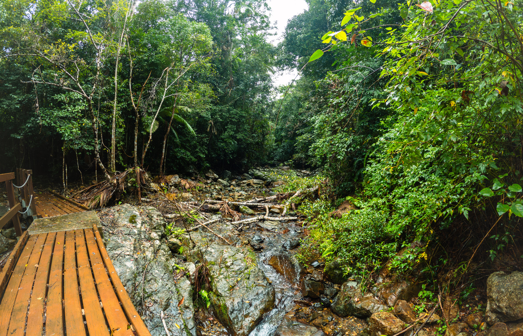
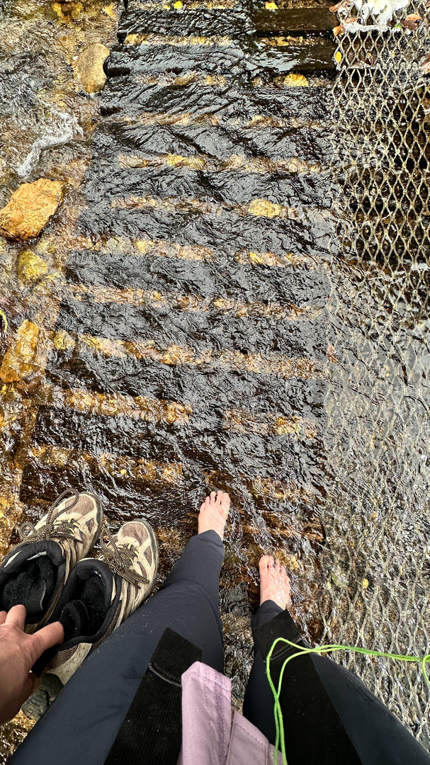
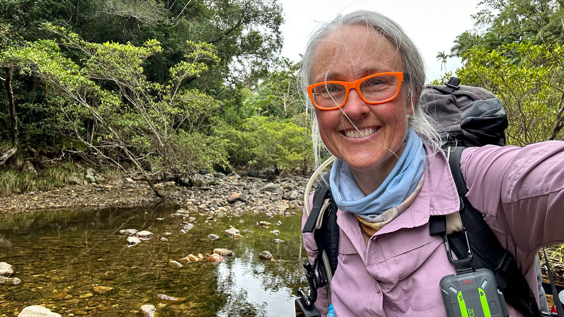
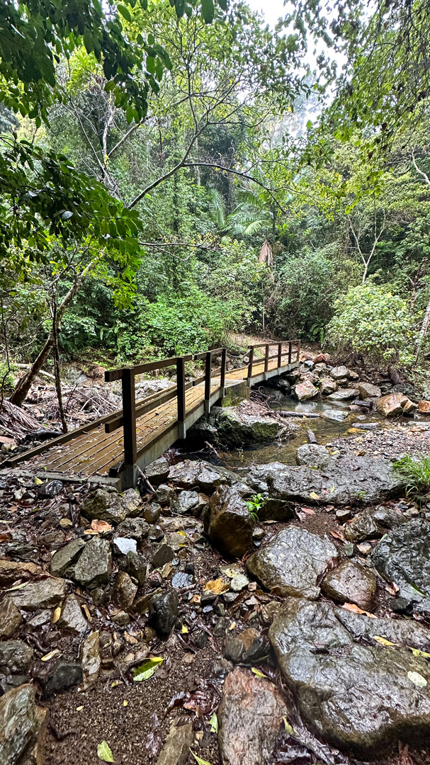
Wait, my heart quickens; here comes the ford where the track crosses Repulse Creek. Something different! Quick grab the camera!
I dance around the creek, so focused on shooting the ‘new’, that I’m oblivious to the musical layer the water has added to the Wompoo and Silvereye chorus.
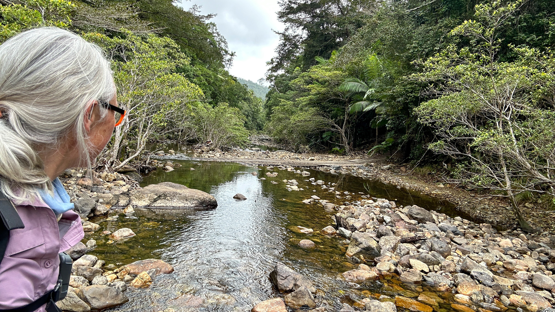

It’s only when I sit down to put my shoes on and judge the site worthy of an early lunch, that I slow myself down to take in what else I see.
My breathing slows and the quiet unhurried life of the place washes over me. Standing to continue, I see no reason to fall back into anything other than a walking meditation; a pace and presence afforded by the simplicity of the terrain. I feel no need to look at my feet which carry me along the multipurpose track, evidence of its diverse audiences of nature lovers: bushwalkers, birdwatchers, mountain bikers, trail runners and even (for the first 4 km) Segway riders. I see none of them on my journey.
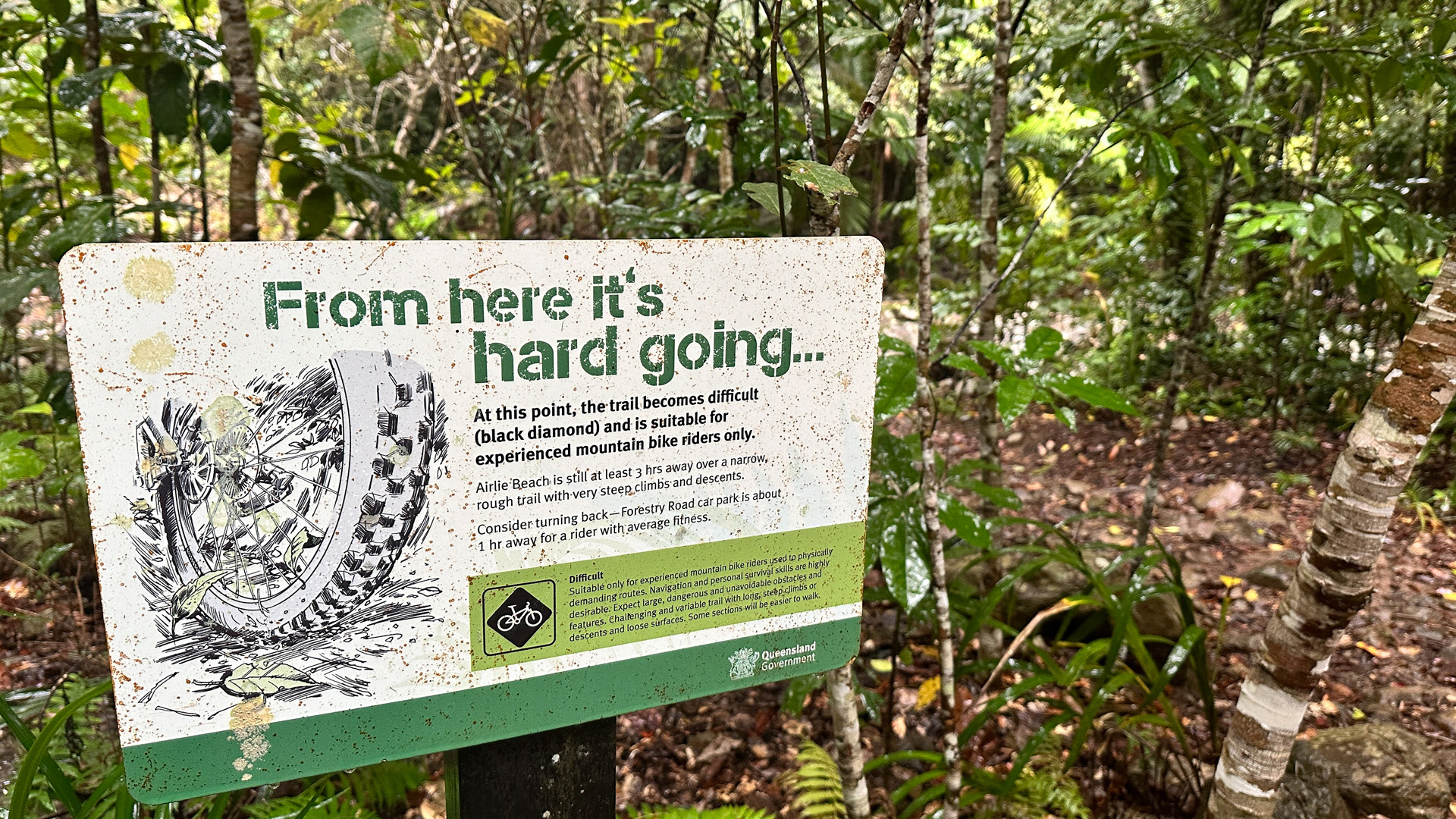
Managing my expectations, I don’t expect the hypnotic pace and groomed gravel to last forever. Rumour has it that this green-graded mountain bike track becomes a challenging black-level route fairly soon after tonight’s campsite at Repulse Creek Camp.
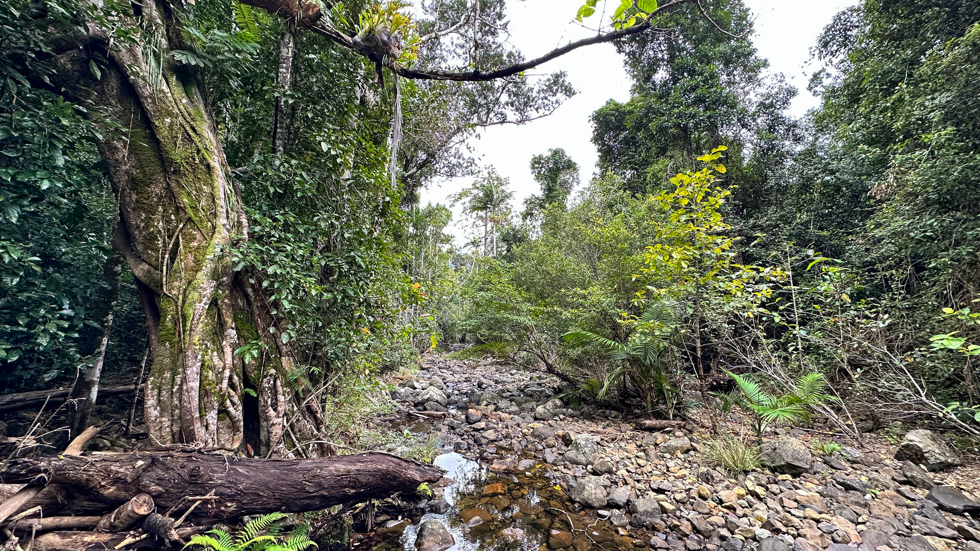
Crossing Repulse Creek, I spy an overgrown narrow track leading south-east, that dives headlong into the verdant jungle. Forever the curious navigator, the QTopo map seems to suggest it leads up a 200 m high knoll and I wonder if it goes. A hunch tells me, ‘not anymore’, as it betrays the history of the Conway Circuit from selective logging that took place on these ridges up until 1993.
Today, it’s not only my schedule that keeps me on track but the sight of a Giant Stinging Tree; they always give me the ‘none shall pass’ shivers.
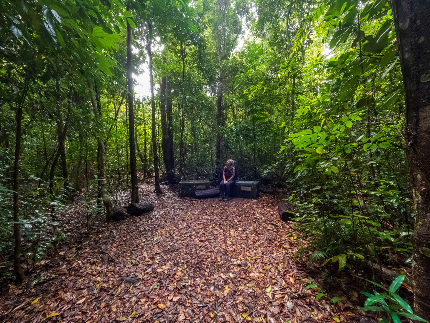
Emerging from the rainforest tunnel, I am birthed into the Repulse Creek Campsite. It’s hard to work out if the trimmed grass under unusually open skies is due to the work of the rangers I passed as they headed towards the trailhead in an ATV or hungry mammals.
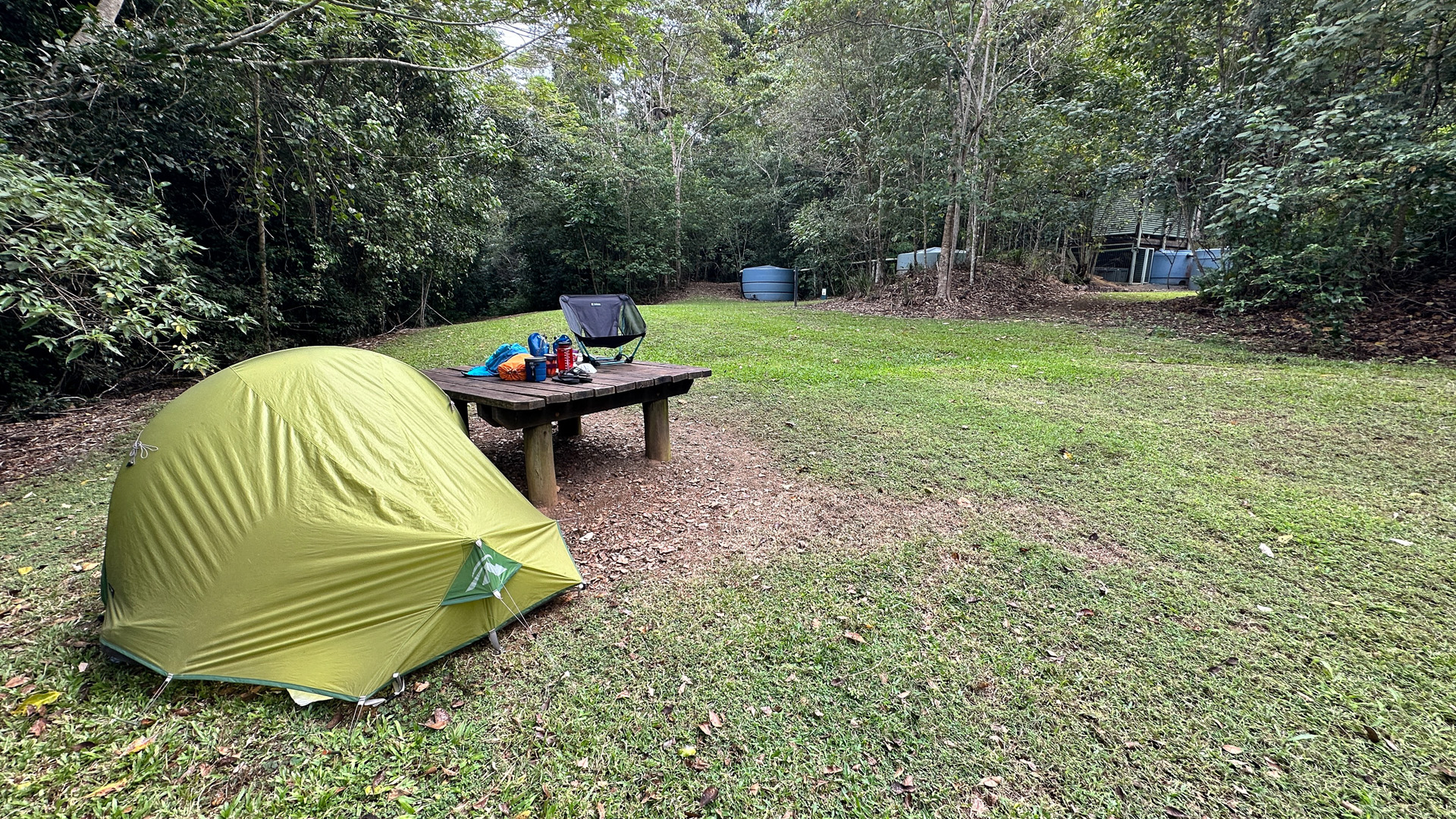
Wandering up a ramp to the composting loo, I start to wonder if this site was built for an even greater diversity of users, making it accessible to TrailRider wheelchair users.
If exposure to this much sky was too much of a shock, I could have chosen one of a handful of rainforest campsites, set amongst the forest like a Bower Bird’s walled-haven. All of the campsites feature a timber platform for keeping gear (not tents) off the ground and are handy for cooking or relaxing on.
Day 2 – Repulse Creek Camp to Airlie Beach (19 km)
Throughout the night, I imagine the pitter-patter rain on my tent as it starts the long journey to the coast and the Great Barrier Reef. As I set off in the morning, the gentle tinkle coming from the creeks I had heard yesterday, is replaced with a chorus of determined flow – in wet season this gentle melody would be a full orchestra.
About half a kilometre after leaving camp, a generous rock-rimmed swimming hole in Little Repulse Creek revealed itself through the trees. If this was a warmer day, it would only take a minute for me to indulge in the first of many jungle swims.
There were more reasons than just the weather that was urging me to keep my pace up: Rather than taking 3 days for the 30 km-ish track, I was pretty convinced after looking at the contours of the map, that it was achievable in two.
Had I made a poor choice, pulling up stumps after a short and easy day one, rather than pushing on to the second campsite at Bloodwood Camp and getting the 400 metres of vertical ascent out of the way? Maybe.

It didn’t take long for the tougher terrain to appear on the inevitable ascent towards Mount Hayward after Parks Queensland’s tell-tale sign. The trail quickly became technical 4WD terrain as the walls closed in towards a cosier single-track. Gravel gave way to clay, where evidence of pig digging signalled one of the challenges that Queensland Parks face in this area. I startled a couple of porkers, who answered my calls of, ‘Hey, Bacon!’, (as I paid homage to TV’s US Alone series regular call of ‘Hey, Bear!’) with grunts and snorts as they ran off into the forest.
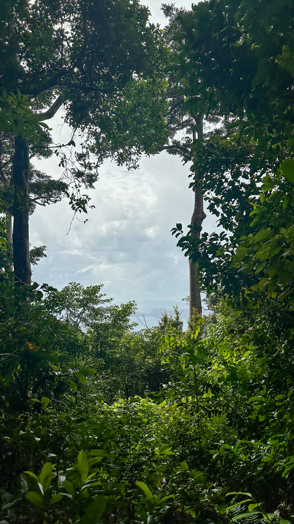
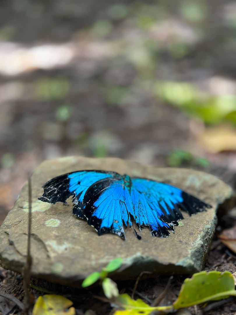
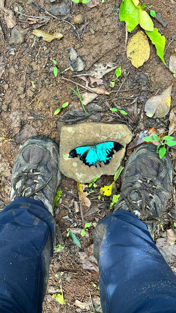
Arriving at the Hayward Lookout, I’m afforded a small window out to the islands of Tancred and South Molle. Mildly underwhelmed, I’m startled by the vivid blue contrast of a sad Ulysees Butterfly that lays dead at my feet; reminding me of parts of the colour spectrum that I’m missing.
Recovering my jaunty gait after summitting Mount Hayward, my mind went to one of those crucial questions that only appear when walking solo for days: do pigs have knees? I tried to imagine a stumpy-legged porcine trying in vain to climb steep terrain and wondered if that explains why the track was so nice from this high point onwards.
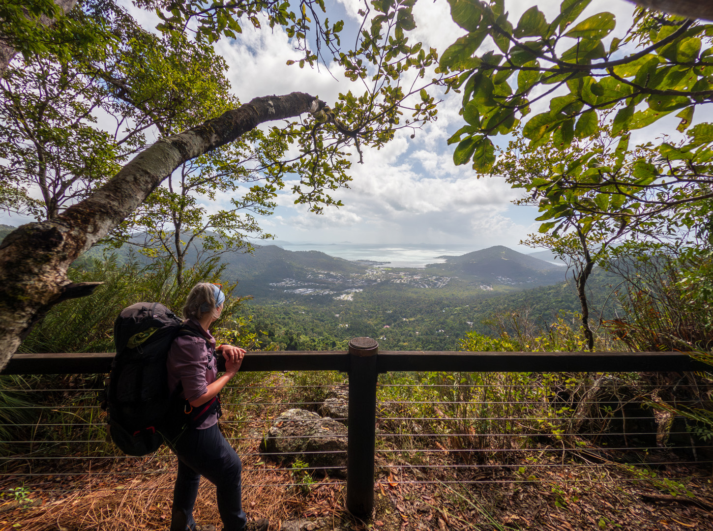
Loping down to Bloodwood Camp, I answered the burning question of my campsite choice. Happy to have chosen the open skies of Repulse Creek camp, Bloodwood’s nest-like spaces in the rainforest, with secure food boxes, ran a close second and the nearby lookout won hands-down for great lunch spots with views over Airlie Beach.
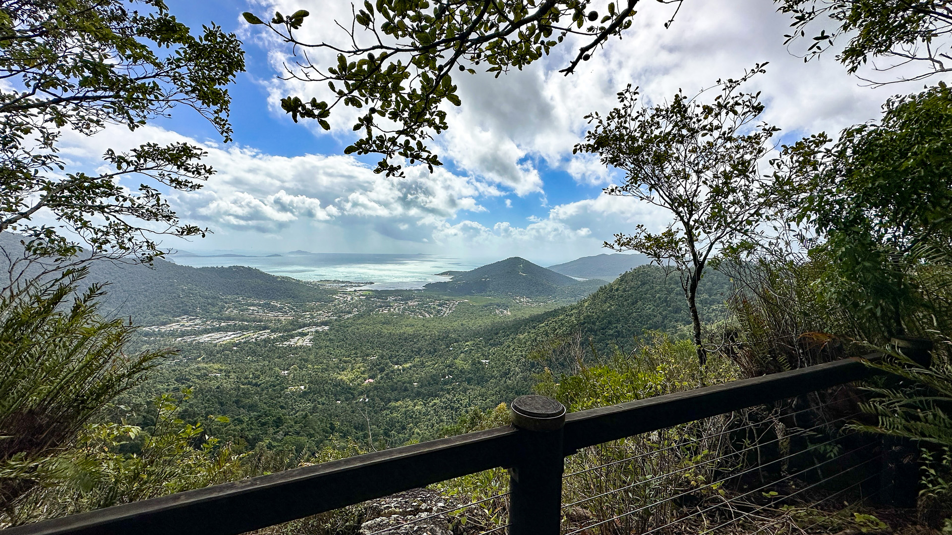
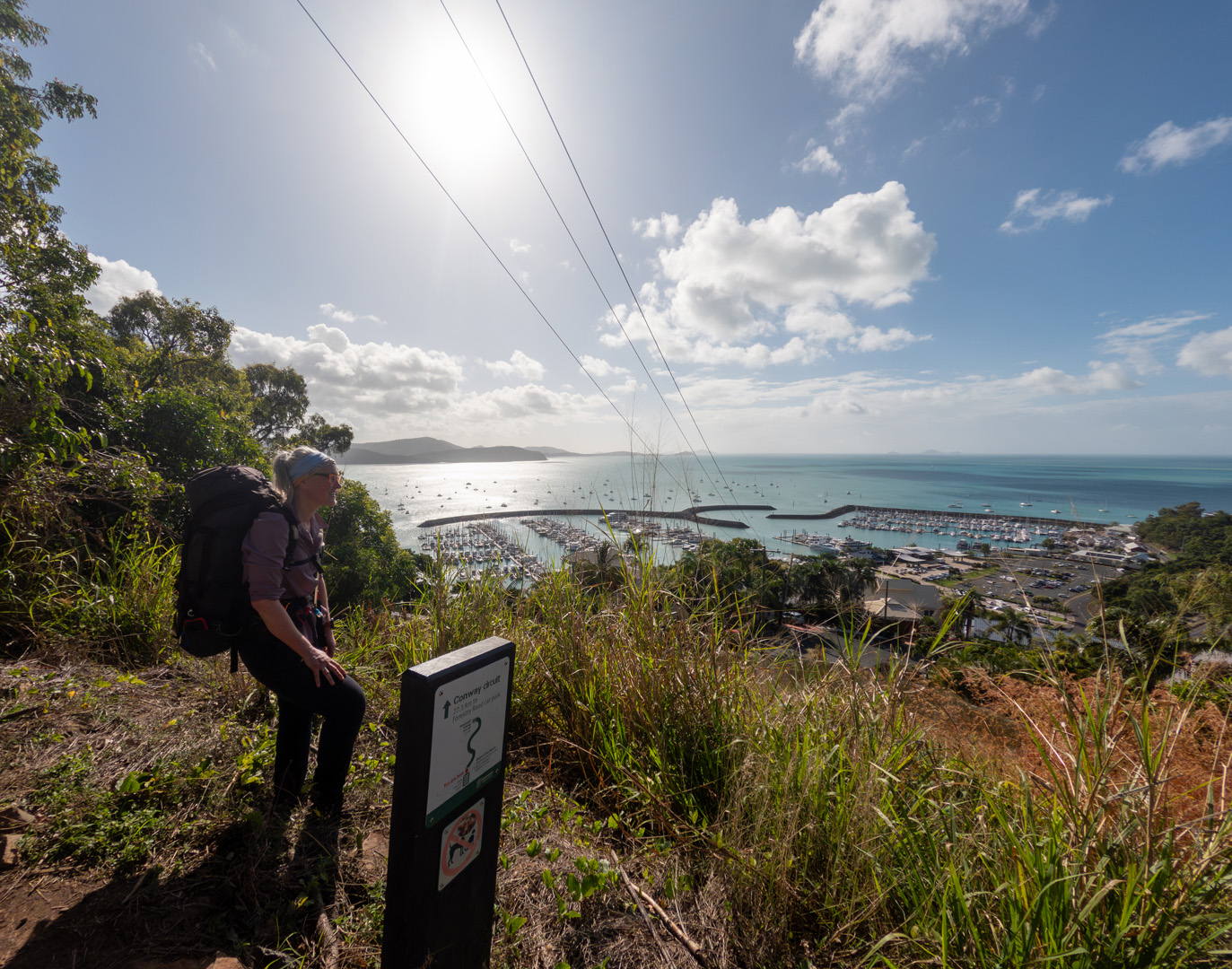
Views proved tantalisingly unrealised, as the track hugged what I knew was the edge of the escarpment, to the junction of Honeyeater Lookout track. The rainforest re-focusing me once again to the beauty to be found inside her embrace.
This junction marks the threshold of popular day walk territory and the multiday Conway Circuit that I was taking. From here, the well-formed and maintained track braces me for the disco-knee wobbles that the 350-metre descent into the tourist vibes of Airlie Beach brings. On the way down I pass 5 groups of hikers puffing their way to the top; I haven’t seen anyone until now and their perfumed cloud reminds me that I must stink.
My muddy shoes (and socks betraying a lone leech bite) carry me straight to a cold beer on the waterfront, where all around me is movement, colour, and sounds. Everywhere I look there is something new to gaze upon.
I close my eyes and rest, taking my mind back to the green seemingly sameness of the Conway Circuit knowing that every footstep in nature is different, new and there to surprise.
In the know
- If you prefer a guided experience checkout Bike and Hike Whitsunday
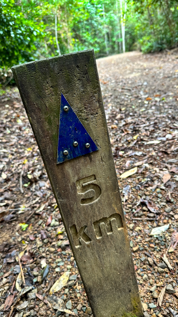
- Track notes, map, terrain profile and GPX file can be found at Trail Hiking.
- Caro was a guest at (and recommends) The Sebel Airlie Beach… checkout my YouTube short as I walked in the door!
- Want to see the Conway, but lack mobility or fitness? Try a segue!