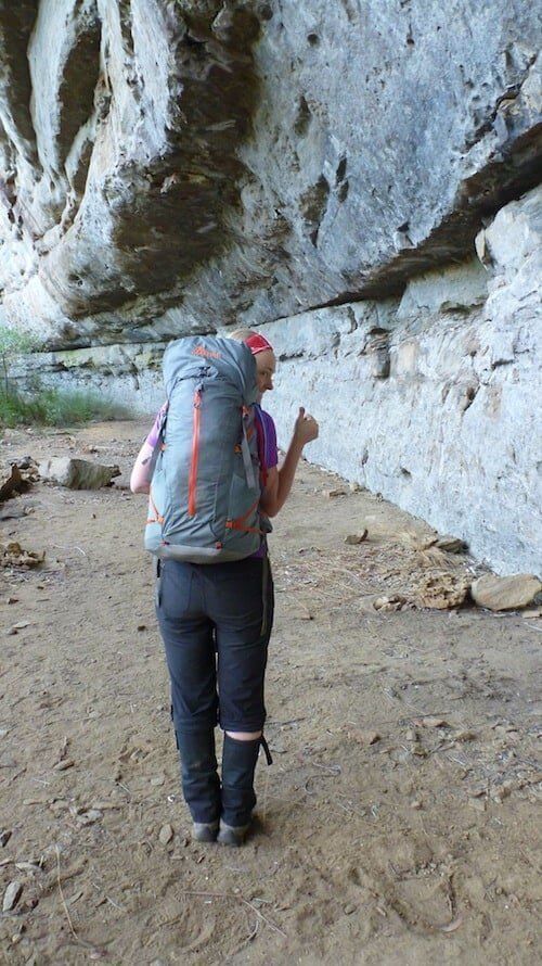
Australian topographic maps are created by each of the state governments. In recent years, most states have begun moving through a digitisation program where they no longer sell paper maps, moving all their mapping resources online instead. There’s some great benefits to this (and yes, a few negatives), as it allows many of us to access and download topographic maps and choose to print them in a way that works for us or use them in conjunction with a navigation app.
Step by step video guide to downloading and printing topographic maps

Where to get Australian topo maps for hiking and bushwalking
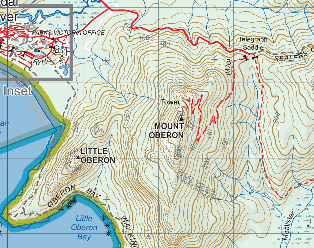
NSW and ACT Topographic Maps
- NSW Spatial Services – Topographic Maps
- NSW SIX maps eTopo – Topographic Maps
- NSW Topographic Map Catalogue
- Spatial Services – Other maps
QLD Topographic Maps
VICtoria Topographic Maps
- Vicmap (general info & options)
- Vicmap Viewer (purchase print or digital maps)
- Vicmap Viewer App (in-app purchase digital maps)
TASmanian Topographic Maps
- Land Tasmania – Tasmap
- Tasmap eShop (purchase printed and digital/download products)
- Tasmap 1:50,000 map catalogue
- Tasmap Tourist/Recreation Map catalogue (eg: South Coast Track, Maria Is, Bruny Is, etc)
South Australia SA Topographic Maps
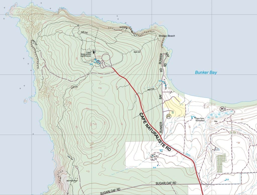
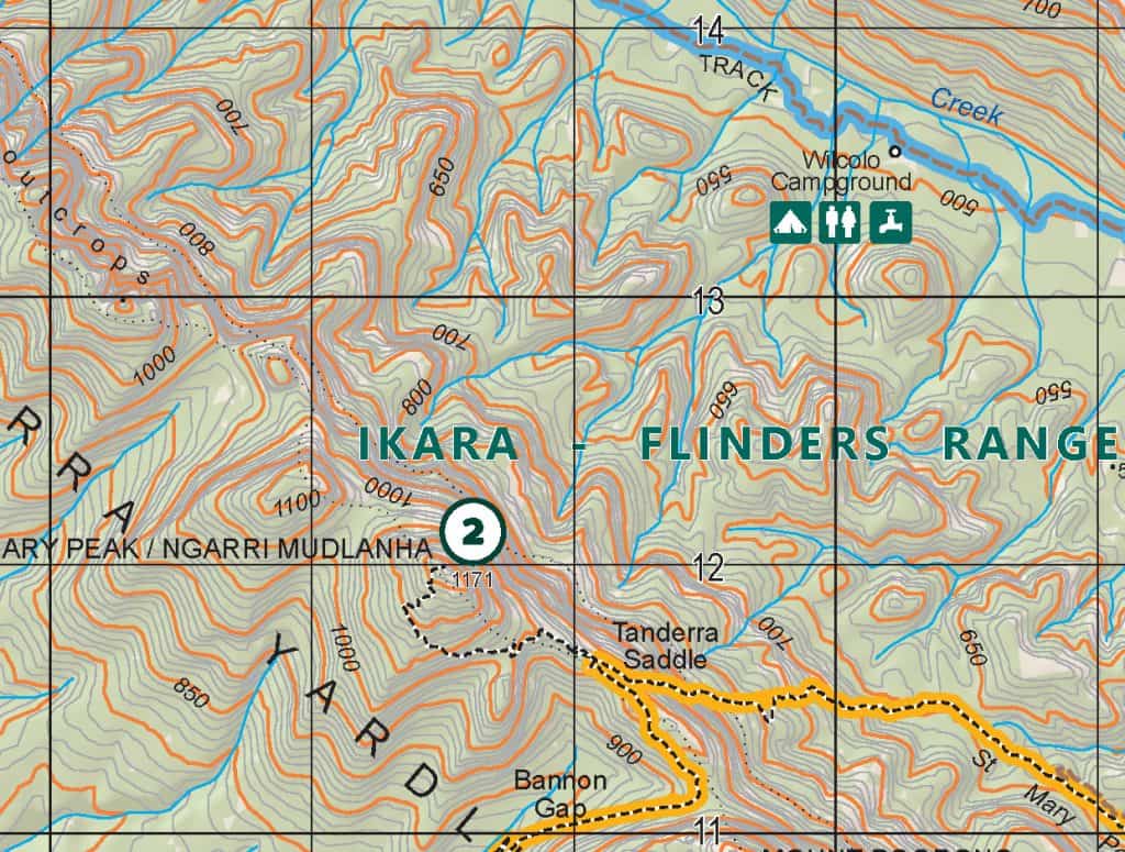
- SA 1:50,000 map catalogue (only available for the southern part of the state, including Ikara/Flinders)
- Mapland (SA Government retail arm)
- Retailers
- Digital topographic maps via Avenza (navigation app)
- NatureMaps ArcGIS platform (create your own maps)
Western Australia WA Topographic Maps
- Landgate (WA Gov) (purchase PDF for printing)
- WA topographic map catalogue
Northern Territory NT Topographic Maps
New Zealand Topographic Map Downloads


Apart from the state government maps, there’s also a collection overseen by Geoscience Australia at a federal level. This map index may help you find what you need, along with some helpful links down the left-hand side.
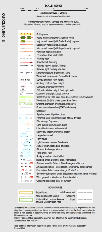
Topographic maps for hiking FAQ
Can I still buy printed paper topographic maps?
Yes, even if the state government body isn’t printing them anymore. The decision for some government departments to move away from printing and selling maps has opened up an opportunity for specialist map sellers (like ABC Maps or Map Centre) to download the PDF and print on our behalf.
This is something you can do yourself (ie. send the digital PDF file [usually around 50MB] to a printer/Officeworks for them to print on large format printers), or print sections on your own A4/A3 printer (watch out for scale!).
Are they the same as the original government printed topos?
The topographic information will be the same if they’ve used the government map file, but in states like NSW there are some ‘key’ (cough) differences. Generally, they are only one-sided which means we miss out on the orthophoto map (aerial image) that used to be on the back page and other info from the key.
In NSW , this means that the magnetic declination diagram has been replaced with a text description, along with some extra technical information that is no longer included. This includes (surprisingly… and please someone correct me if I just can’t find it), the datum (eg: GDA94 or GDA2020) and the UTM 100,000 grid zone.
On some sites you have the option to download a map “with collar” (including the legend/key and other helpful info I like to call the fine fine print) or “no collar”, without (this is handy if you want to join several maps together).
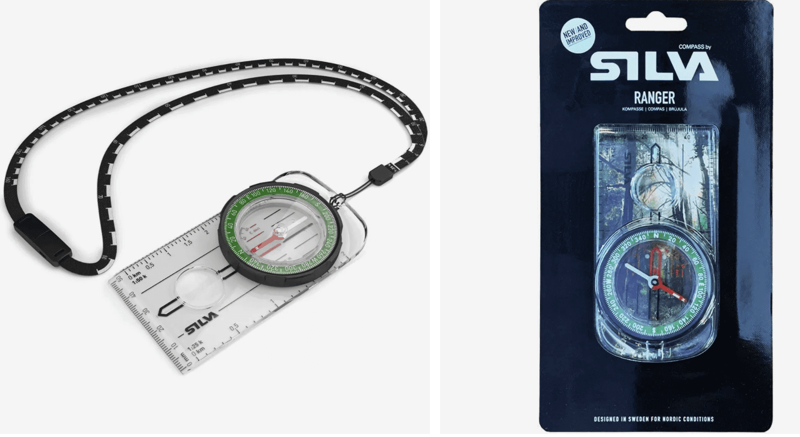
What compass to use for bush navigation
There’s lots of different types of compasses on the market, so if you’re jumping into map and navigation for outdoor adventures, these are the ones I’ve used for 15 years and recommend:
Silva Ranger 3 – Buy now from Macpac
Silva Ranger – Buy now from Snowys
Both of these are what’s called a ‘Baseplate Compass’. Specifically, they feature the two key things to look for:
- a long baseplate (there are stumpy, short ones available which aren’t great for taking bearings over distances greater than 2km)
- 1:25,000 and 1:50,000 scale
- a great mid-range price (you can pay over $100 for other compasses!)
This article is an additional resource to my book, How to Navigate – the art of traditional map and compass navigation in an Australian context. It provides links to the various Australian State Government mapping organisations, so you can buy (or download and print) topographic maps for your hiking, bushwalking and other outdoor adventures.