It didn’t matter whether we saw flames, smoke or just watched on physically disconnected through our digital devices, the summer of 2019-2020 will leave a scar on us all long after the epicormic growth has sprouted.
Now that the immediate crisis has passed and we’ve moved to recovery, we’re trying to figure out what that means. We are curious to see our precious and damaged natural places for ourselves, rather than through the lens of social and other media, driven-on by our craving for calm and a sense of peace that was lost during the crisis.
Feeling the claustrophobia of a caged animal, we are longing to run-free in our favourite wild places, for not only our physical well-being but our now critical mental health.
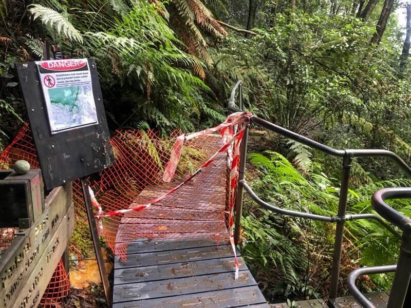
Scrolling through the National Parks alerts, it’s easy to get frustrated with the long lists of areas that are off-limits to us and I started to wonder about the reasons why we shouldn’t be entering closed national parks. Some are obvious, others frighteningly less so. Here’s why:
It can cost a lot of money
We’ve all seen the signs and read the throwaway line of ‘fines apply’, but if you think the chances of getting caught are worth the risk, the cost can actually be substantially higher.

Insurance policies are voided if you enter a closed area
According to the Insurance Council of Australia, if people enter an area that is closed by authorities and something happens, you won’t be covered. The terms and conditions of insurance policies and even the words ‘product disclosure statement’, seem to be designed to induce a microsleep, but the lawyers who put these things together mean serious business.
Medicare doesn’t cover the cost of ambulance (including helicopter evacuation) for Australians. Even if you have private medical or simple ambulance insurance and injure yourself in a closed area – you’re not covered and have no leg to stand on… that is if you can!
In 2019, there was a tragic incident near Cairns where a local couple died in a fall within an area that was closed. If they had been tourists, visiting on travel insurance, all costs associated with evacuation, medical treatment and repatriation back to their families overseas, would need to be paid by the family. Just devastating.
You can get fined
The NSW National Parks Legislation 2009, (actually more interesting than reading insurance terms and conditions), outlines the fines that can be issued for entering a closed area. Each state and territory operates under their own legislation, so you’ll need to check with the relevant land manager in each area.
The risks of injury are increased
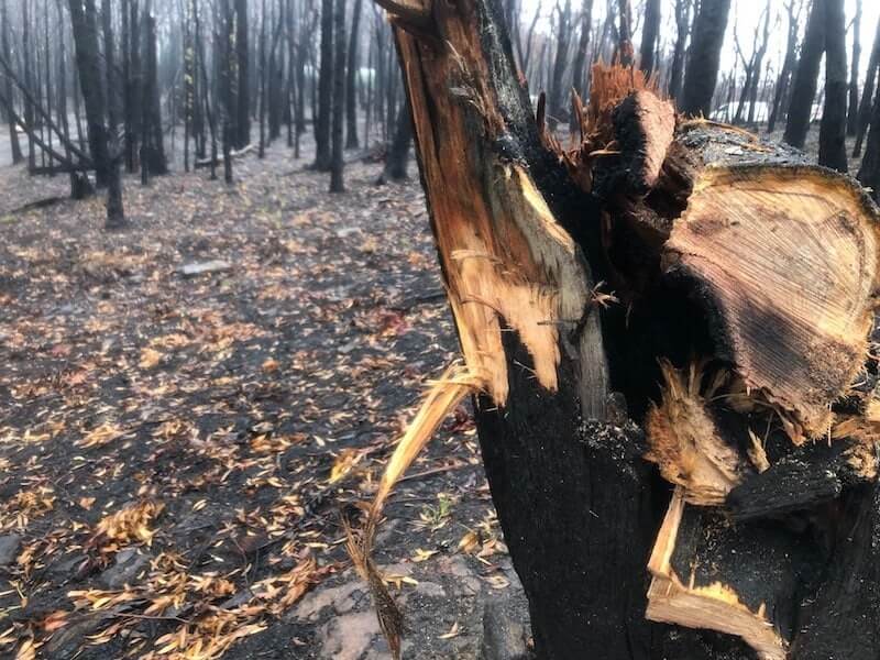
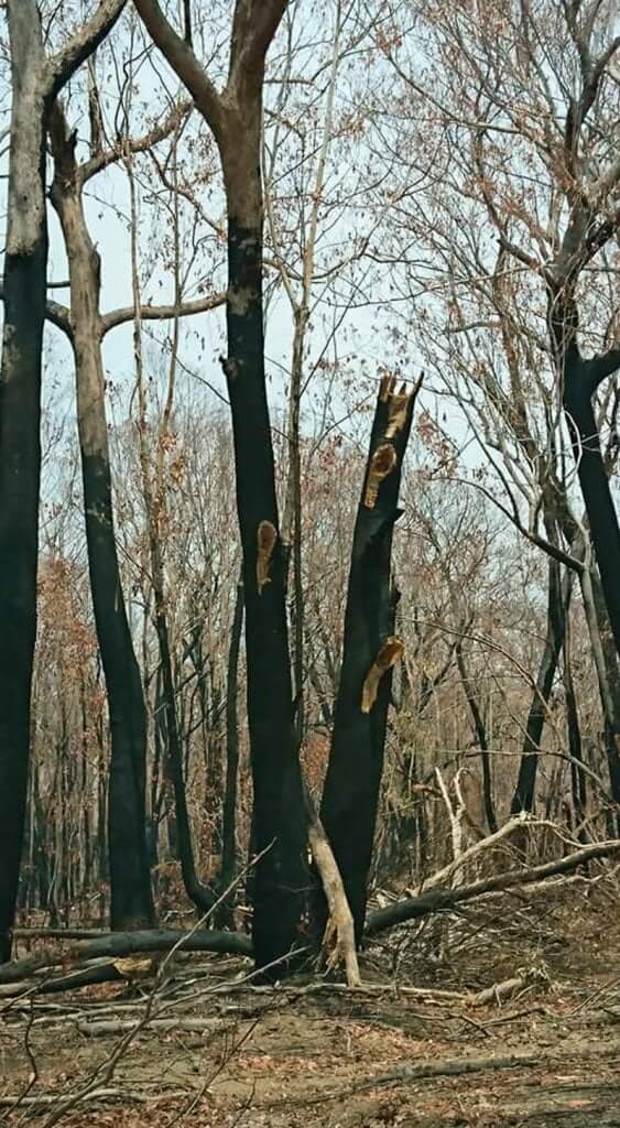
Dangers from falling trees
Just because the fires are out, it doesn’t mean that it’s now safe to enter. Bushfires can create and reveal risks previously hidden. The obvious ones are burns or smoke soon after the fire has passed, but for months afterwards, falling trees and large branches can drop with no warning. There are also more subtle risks such as old asbestos structures (or even illegal dumping), that can become visible and compromised after a fire.
Feral Animal Control
When there is so little feed on the ground for animals after a fire, the battle for survival between our native animals versus introduced ferals is a challenging one. Land Managers may use this period of time, when there is little visible cover, to undertake feral animal controls such as baiting or culling. Rigorous risk assessments take place beforehand, closing areas to the public. It makes sense not to be in an area where culling is taking place.
Ecologically you’re making the situation worse
Ask an expert
I’m no ecologist, but Roger Lembit is. He is well respected by his national parks clients and industry colleagues to assess areas post-fire (amongst lots of other interesting work #dreamjob). I asked him about the reasons why we shouldn’t enter a closed park after a fire.
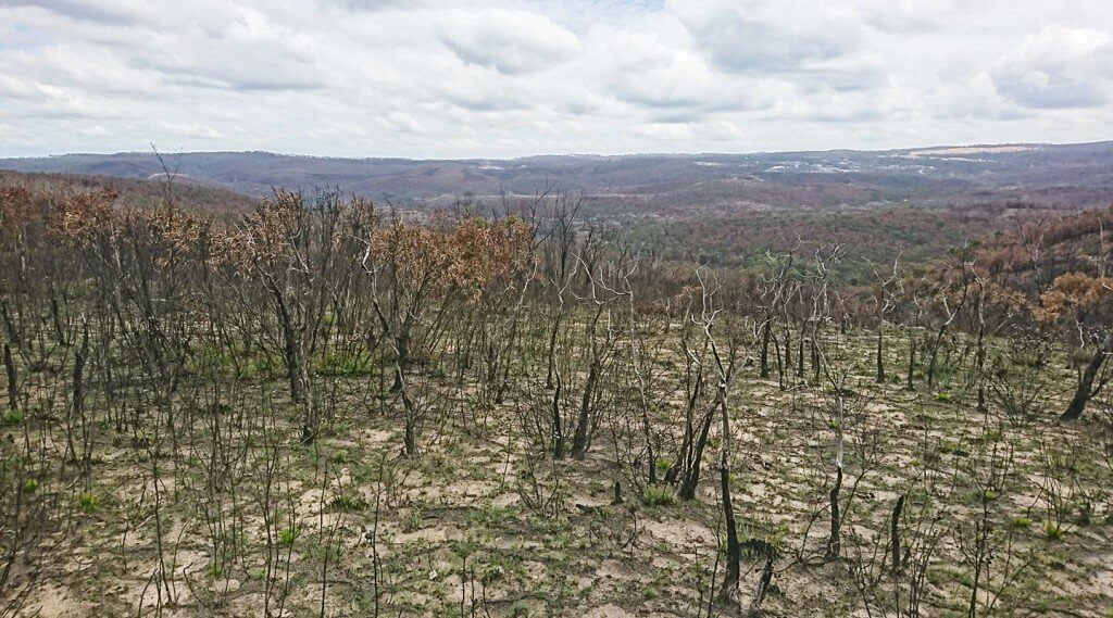
Soil Erosion
“An important reason for maintaining closures of sections of National Park post-fire is the risk of soil erosion. Following intense fires, there is very little ground cover and rainfall has a more damaging effect. Soil erosion leads to sedimentation and pollution of waterways as soil nutrients are mobilised and transported into streams. This can cause toxic algal blooms.
It can take just seven passes by human foot for a clear pad to form. Such pads/tracks then become channels when rain falls.
Roger Lembit, Ecologist.
Walking Track Infrastructure
Another issue is track infrastructure. A lot of work is needed to replace erosion control structures such as steps and drains along tracks. NPWS first priority is to repair popular tourist walks, so more off-beat tracks can take months or more to restore.
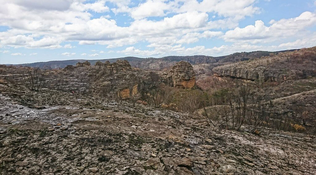
Canyons
Canyons are not sensitive habitats as significant rainfall events will lead to much change. This has been the case for thousands of years. However, they are far more dangerous after a fire as heavy rainfall and the increased runoff can lead to flash flooding. There is also the problem of soil erosion along access tracks [and newly submerged fallen trees that might be in jump zones].
While ground plants start to regrow within a fortnight of a fire, it takes well over a year for there to be sufficient cover to reduce erosion.
Weeds
Weeds are an issue too, but sensible protocols such as cleaning boots/Volleys and spraying soles with 70% ethanol can reduce weed spread and the spread of root pathogens.”
Phytophthora / Root Rot
We all watched-on in wonder as teams of Blue Mountains National Parks staff fought hard to protect the Wollemi Pine from the Gospers Mountain fire. Many of us would also have heard that the fire wasn’t the first major threat that the pines have faced in recent years. Whilst a lot of work had been done to keep the location of the pines secret, the emergence of phytophthora in the area demonstrated that thoughtless people had been accessing this site and unknowingly, carried this devastating mould in with them.
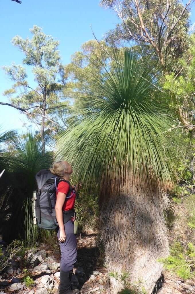
This pathogen is particularly devastating to Xanthorrheoa grass trees, waratahs and others in the banksia family. The nuts and fruits of these trees are popular with black cockatoo, wattlebirds, lorikeets, honey-Eaters, spinebills and silver eye.
Whilst post-fire conditions might seem an ideal time to head out and make discoveries (like hunting for new rock climbing routes suddenly devoid of thick scrub) these off-track forays can result in the spread of phytophthora in areas such as Narrowneck in Katoomba.
Conservation and environmental activism
Ask an expert
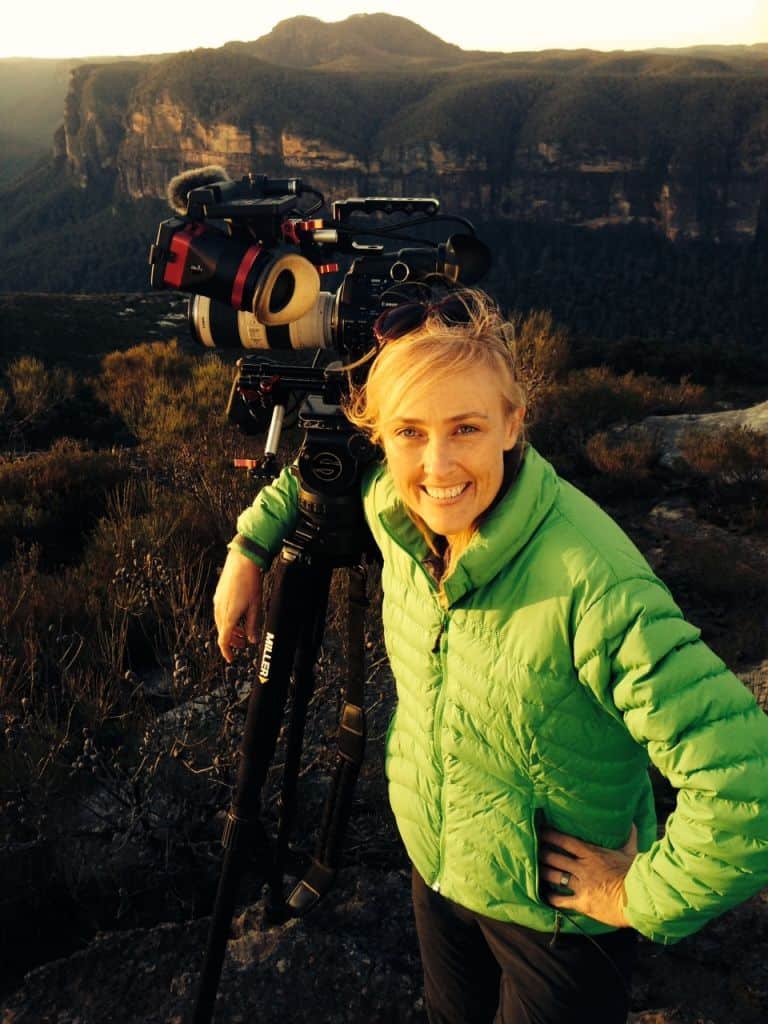
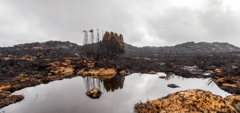
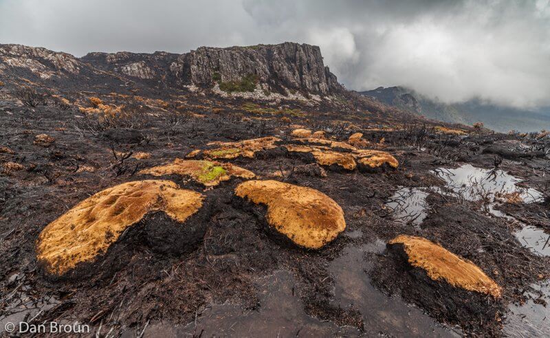
I can vividly remember Dan Broun’s stark and engaging photographs from the 2016 Tasmanian bushfires. I wanted to hear his thoughts from a long term environmental point of view:
“As a conservation and environmentalist photographer, I have differing opinions on entering a fire ground. These opinions are very much driven by the outcomes associated with taking and distributing the resulting images.
If there is no gain for the environment then staying away is absolutely what I believe photographers and everyone should do.
The exception for me came in 2016 when wildfires had raced up to the Central Plateau of Tasmania. I know this area well and I knew ancient stands of Pencil Pines were being impacted.
I also knew fire crews were sitting at the town of Chudleigh, a short distance away, doing nothing to fight the fires engulfing this global treasure. The fire crews were doing nothing because human life and property were not at risk and policy was to let wilderness fires burn out naturally.
I took the opportunity to hike into the area because I needed to highlight to the world what was happening and wanted to see that policy change. Because I knew the country well, I had planned escape routes and had watched the fire’s movements.
The scene was stark and emotionally devastating.
The resulting images have been seen by hundreds of millions of people around the world, the exposure prompted a senate inquiry and the issue of wilderness fires received much-needed attention.
I made this two day trip to get media attention and to force authorities to act – it did both of those things.
In the more recent 2019 wilderness fires, this type of action wasn’t necessary, primarily due to the actions taken in 2016.
Conservation groups with legitimate concerns about ecological damage and impacts to wildlife should be part of the secondary response to any fire. These groups are the ones best equipped to mobilise volunteers and fundraise for ecological restoration and emergency wildlife feeding programs, they should be sanctioned to safely enter fire zones.
There is no reason for anyone else to be on fire grounds.”
Where to walk when everything is closed
The images we saw on the media would have us believe that all our precious parks are now lunar landscapes. Yes, large areas of our favourite or most visited spots might be closed at the moment, but us outdoorsy folk are creative types. It’s the time to dig into some research, pore over maps and wonder about the bits of green on them you’ve never noticed before.
You might be surprised by spots you didn’t expect to find green space. They might not be national parks, they might be nature reserves, state forests or green corridors managed by local councils or Lands Department. They could be places you’ve discounted in the past for one reason or another – now is the time for exploratory, discovery and that over-used word – resilience.
A word about Parks alerts and off-track areas
Land Managers publish closed area alerts on their websites. These lists contain the names of tracks, trails, campgrounds and areas that are closed. In times like this, when Parks resources are stretched, us users need to exercise a bit of grace and think broadly about what they’re trying to communicate. It is simply impossible to list every single track, canyon, valley, ridge or spur within a given area. Rather, it’s safe to say that if two named tracks are closed in an area, then the off-track section between them is also closed. Let’s be smart about this, eh?