Unfortunately, not every callout ends well, so when I received an SMS alert* late one hot Summer’s afternoon for a PLB activation on the Kanangra to Katoomba K2K route, in the remote Kanangra-Boyd National Park, I feared the worst for this solo walker.
However, unlike other callouts to this same route (two I’ve been involved in didn’t end well), thankfully, this one did. It was resolved with what I call the ‘first sweep’ of assistance from Polair and Police Rescue wrapping everything up in good time. Nice one.
When things go wrong in the bush, I think one of the most valuable things we can do is learn as much as we can about what happened, to try and prevent it from happening again.
In the past, there’s been a well researched Australian online accident register, with balanced reports and links to coroners findings. However, due to the time and resources needed to put it together, it’s sadly no longer available. (I’d love to see this type of public record available again, so if anyone has any ideas (or funding!) there’s a gap there! Check out the International Canyon Accident dbase for some inspiration!).
So, back to that Sunday night… apart from being relieved when we were stood-down in the knowledge that the missing person was safe and well, I was delighted when I saw them posting some details about their experience on social media. Huge thanks to Chini for being brave enough to share her story and for answering a few of my questions, that she’s happy for me to share with you here.
Caro: How did you hear about the Kanangra to Katoomba walk?
I first heard about the walk on some online bushwalking forums. Also, when I was out hiking in the vicinity of the Wild Dog Mountains (around Dunphy’s Campsite, Tarros Ladder and Medlow Gap) I saw mention of the walk on some signposts. I was chatting with some experienced elderly hikers out there who recommended the walk to me and some friends I was with. However, I don’t think they expected me to walk it alone, or in the middle of summer.
Caro: How did you decide that you were up to this challenging hike?
I knew that the terrain of the K2K would be worlds apart from that of the Six Foot Track and would require a lot of time spent navigating. This is why I chose to complete it over 3 days, even though I have easily walked the Six Foot Track alone over a single day.
I thought that I would be able to complete the K2K since I have gone on numerous solo day hikes and solo overnight hikes in the Blue Mountains which traverse rugged terrain and require a bit more navigational skill (eg: Mount Solitary and numerous hikes descending/ascending into the Grose Valley like Pierces Pass, Perrys Lookdown, Govetts Leap, and Lockleys Pylon**). I also recently finished the Everest base camp hike so I thought I’d have the endurance to be able to complete the K2K and felt as though my fitness had increased after spending time at altitude.
I knew that the terrain of the K2K would be more rugged than any other hike I have ever done.
However, I vastly underestimated just how rugged it would be.
Caro: Where did you source your route and track information from?
I got most of the information I needed from a website and had also read numerous trip reports from other sites. I was planning on following the itinerary specified on the website where the trip is completed over three days.
Caro: What type of navigation equipment did you have with you?
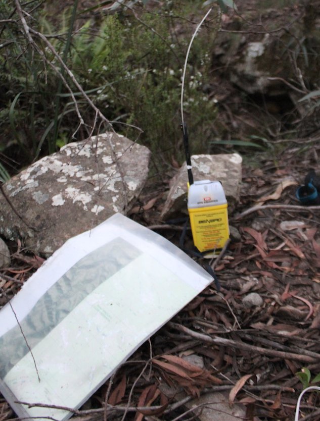
I was carrying the sketch maps and trip notes from the website, as well as my own topographic map, compass and GPS.
Caro: How did you decide to activate your PLB?
My main reason for deploying the PLB was dehydration. I underestimated how rough the terrain would be and I underestimated just how much water I’d need on that hot day. Towards the end of the day, it was my unquenchable thirst for water which caused me to rush down the slopes of Mount Cloudmaker in order to find the closest stream. It was this desperate ‘rushing’ through the dense foliage, coupled with my chaotically negligent state of mind which caused me to lose my GPS. I still trusted my ability to navigate with a map and compass, so I decided to continue forth.
Eventually, I reached a creek which connected to Dex Creek and found it completely dry. At this point, since I felt as though I was on the verge of fainting, was concerned that Dex Creek would also be dry and could see that the sun was setting, it was then that I decided to activate the PLB. I knew that even though my navigational skills were probably good enough for me to somehow find my way back to Kanangra Walls, I wouldn’t be physically able to walk back on my own two feet unless I found water.
Caro: Looking back, how do you feel about your experience now?
I now see that I was definitely not experienced enough to complete the hike on my own. It was foolish of me to go on such a hot day, it was foolish of me to choose to do it alone and I’m ashamed of my overly hubristic attitude in underestimating that wilderness.
If my story can inform you on how to prevent others from making the same mistakes as me, then it’s all worth it.

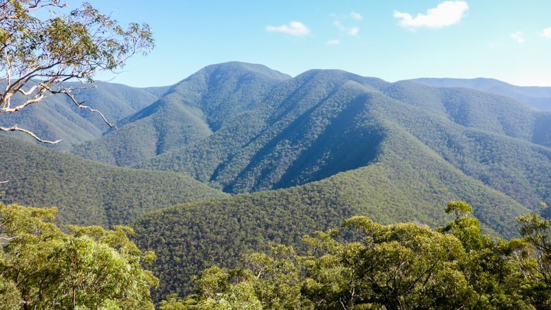
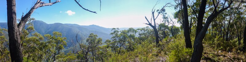
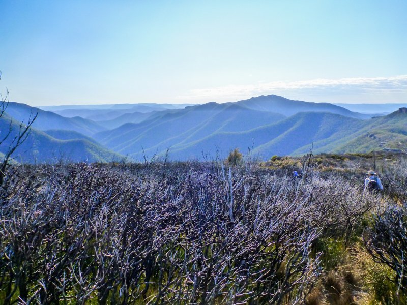
A few thoughts on the Kanangra to Katoomba
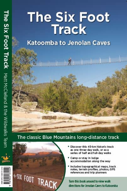
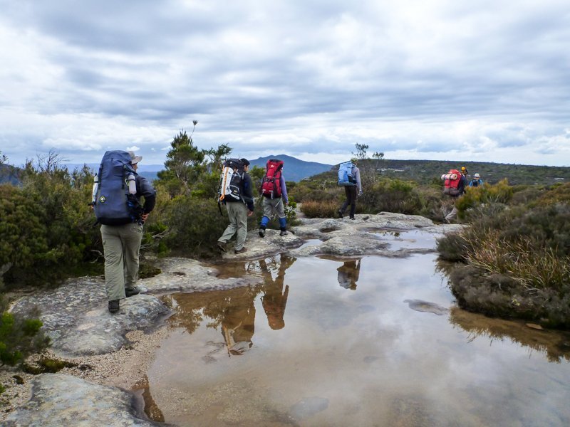
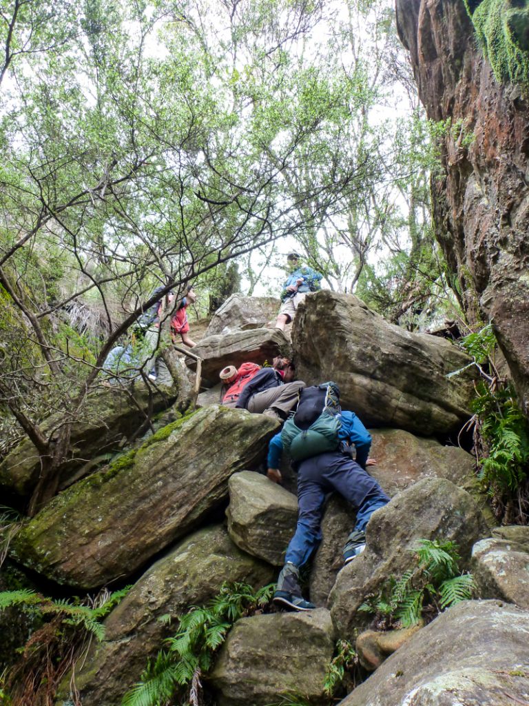
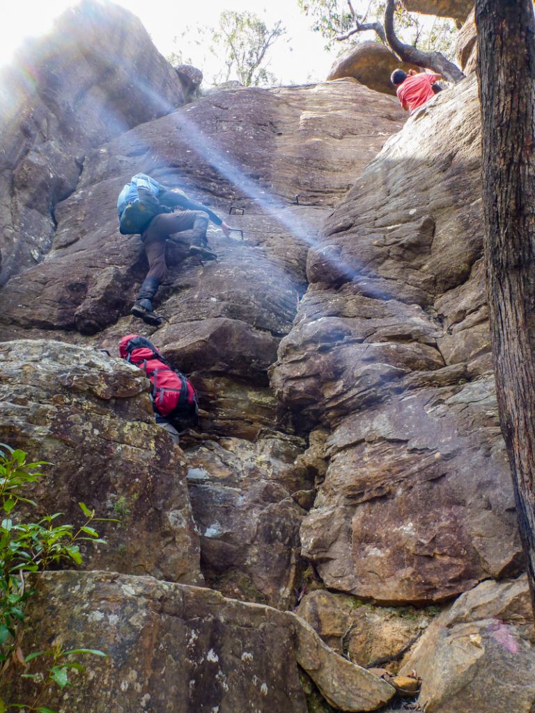
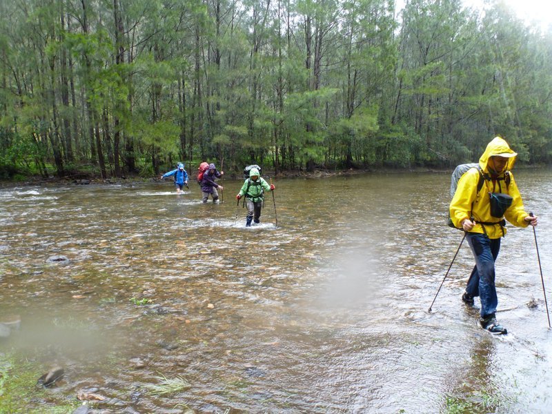
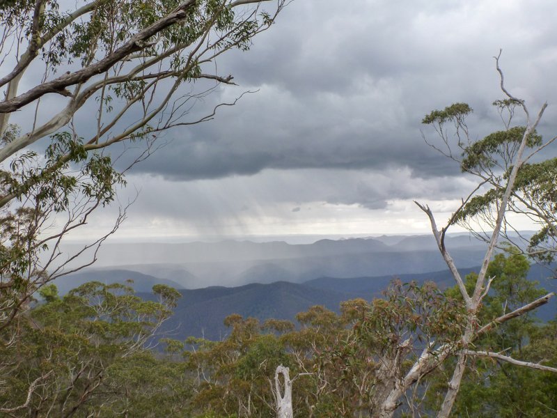
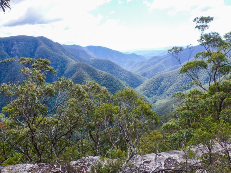
The tricky thing is, unless you’ve had experience in trackless, steep and difficult terrain and have a good working knowledge of topographic maps (and all those contours!), it can be easy to compare distance of a track in the same region and assume that the time needed to complete it could be similar. Whilst the Six Foot Track and the K2K are both around 45kms (and most accounts recommend 3 days for each), they are like chalk and cheese when it comes to the physical and navigational challenges involved.
I know of several search and rescue callouts from people who’ve got into trouble and needed help on the K2K, because they’ve done the Six Foot Track and found it quite do-able. This led them to think that the next logical step-up would be the K2K. Sadly, there’s a few more steps in between!
Relatively speaking, the Six Foot Track is a well marked, 2-3 day hike, suitable for fit and well prepared beginners. Whilst it has a couple of big hills (mostly on fire trails), they can’t be compared with the K2K. The K2K is a tough, challenging bushwalk for people with advanced pack fitness and experienced in wilderness navigation and bushcraft.
A couple of other points about the K2K:
- The K2K isn’t the type of trip to do in the heat of summer, regardless of your fitness or experience. Water is unreliable anytime of year, especially after dry periods. The risks of dehydration are real and can affect your ability to make clear decisions. Every litre weighs a kilo and it’s just not possible to lug all you need over this type of terrain.
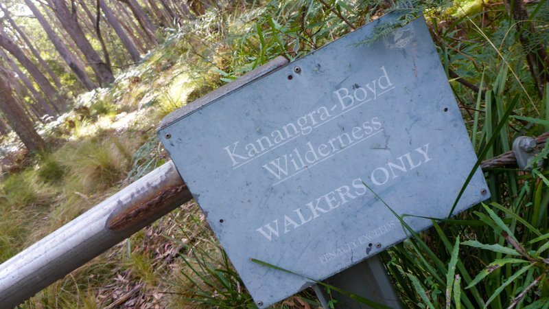
- Importantly, the Kanangra to Katoomba route is in, “Declared Wilderness.” This is a legislated designation which states:
“A wilderness area shall be managed so as:
(a) to restore (if applicable) and to protect the unmodified state of the area and its plant and animal communities,
(b) to preserve the capacity of the area to evolve in the absence of significant human interference, and
(c) to permit opportunities for solitude and appropriate self-reliant recreation (whether of a commercial nature or not).
NSW Wilderness Act 1987
That self-reliant recreation is key. This means that the K2K does not have any trail markings or signs. In many places, there is no track and you must be able to navigate. If you’ve never walked and navigated off-track before, this is not the trip for you.
Six Months Later…
I was delighted when Chini got back in touch with me six months later to report…
“Hello Caro! Just wanted to let you know that I still do lots of bushwalking and I’m still loving it! I have joined a club now so I don’t walk alone anymore. I went back to Kanangra last weekend to have a second go at the K2K! This time I successfully finished the entire walk with no dramas! I went with people from my university’s mountaineering club and had a really positive experience doing it!!
On the first day at Kanangra Walls we came across a couple who had set out to attempt the walk but seemed very unprepared. I talked to them and they only had around 1 litre of water each and they also didn’t seem to be confident with navigation either. I told them about what happened to me and we played a role in convincing them to turn around and not continue the walk so that they didn’t end up suffering what I endured earlier.”
Such a good news story and so wonderful that she was able to share her experiences to help others. Way to go Chini!
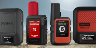
I’m so glad this story had a happy ending and that she now enjoys walking (and now leading) trips with her outdoors club. She was wise to carry a PLB, which you can buy for around $350, rent for a small fee or borrow for free in select NSW NPWS Visitor Centres.
Further Reading: How to Choose a Hike that’s right for you
*as a volunteer with SES Bush Search and Rescue.
** These are popular walks, on well-defined single track, in an area with a variety of exit options. Many of these can be completed as day hikes by fit bushwalkers.