When something goes wrong, one of the biggest issues affecting safety, when bushwalking or hiking in remote areas, is access to reliable communications with the outside world.

There are countless stories of epic search and rescues from days gone by, where people walked or waited days (even weeks) for help to injured people. Plane crashes, injured or lost hikers, floods and fires, many ending tragically, could have been helped by access to good comms.
As an ‘always on’, connected society, one of the real pleasures and escapes from digital tentacles can be heading out into the wilderness, where mobiles don’t work and connection is about the natural world, over the digital.
However, remote area missing person statistics in recent years point to the massive reduction in time to rescue for those needing it, due to the increase in devices such as GPS and Personal Locator Beacons (PLBs).

This is good news for everyone, not only the missing person and their family, but the emergency services and volunteers who go looking for them. Lowering the time to help, makes for better outcomes and lower risk to all.
But something that our connected society has built up, is an expectation that we can always drop someone an SMS to let them know if we’re running late, etc. There’s something about the concept of giving someone ‘peace of mind’ that is more about the other person (your family and friends) rather than yourself.
When it comes to the different types of devices that are available today, they fall into roughly four categories:
- Personal Locator Beacon (PLB)
- SPOT Tracker
- Garmin InReach
- Satellite Phone
Each of these devices has their pros and cons and apart from an expensive sat phone, only one allows for two-way satellite communication – the Garmin InReach.
How is the Garmin InReach different to a PLB?
Although the rise in usage of PLB’s is a good thing, it has also shown a rise in unnecessary activations. Essentially, a PLB has one job – it alerts the emergency services (via AMSA when in Australia) to trigger a rescue at your particular location. It can’t give details or say the nature of the emergency, it simply calls for help. There are stories of people pressing the button simply because they’re a bit tired or running a bit late. These types of activations are not only costly, but put the lives of the rescuers at risk. PLBs should only be used for life-threatening type emergencies such as genuine injuries, medical emergencies or being lost preventing a standard hike out.
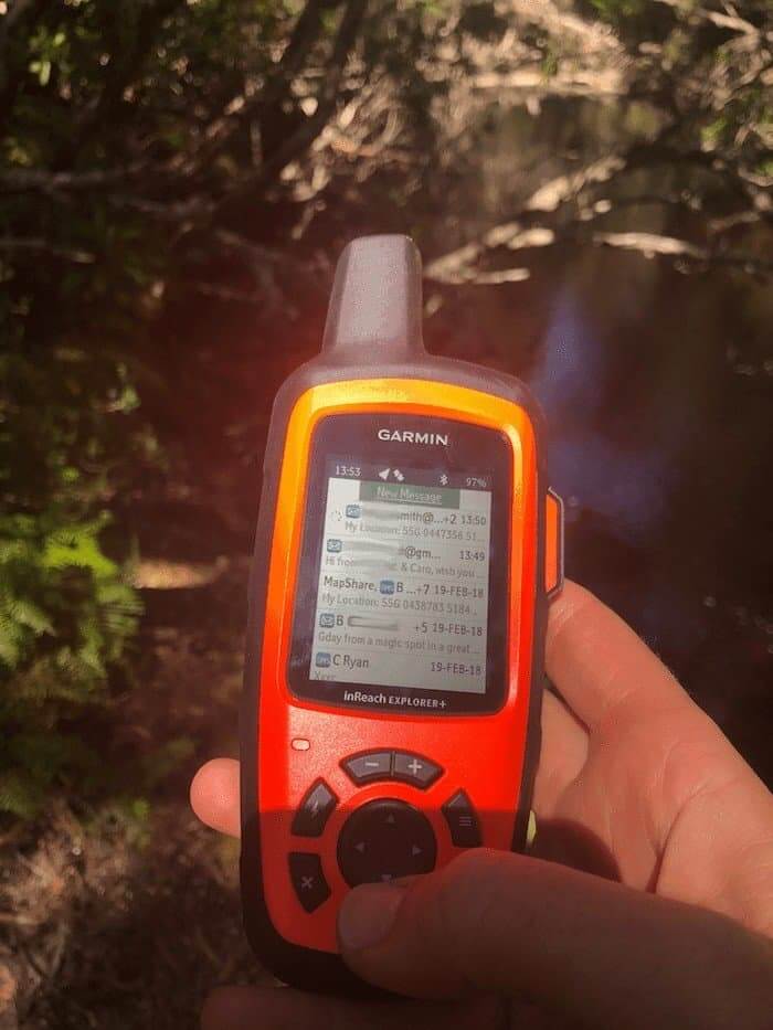
Because the Garmin InReach is an Iridium (global) satellite two-way communicator, when you hit the SOS button, you are responded to by people 24/7, in a third party emergency call centre, who can not only acknowledge the message, activate the rescue (back via your own countries emergency services) and provide an ETA of help, but can give you medical or survival advice for the current situation. I believe that this is the primary reason why someone should invest in this type of device and certainly the reason why I’d like to carry one.
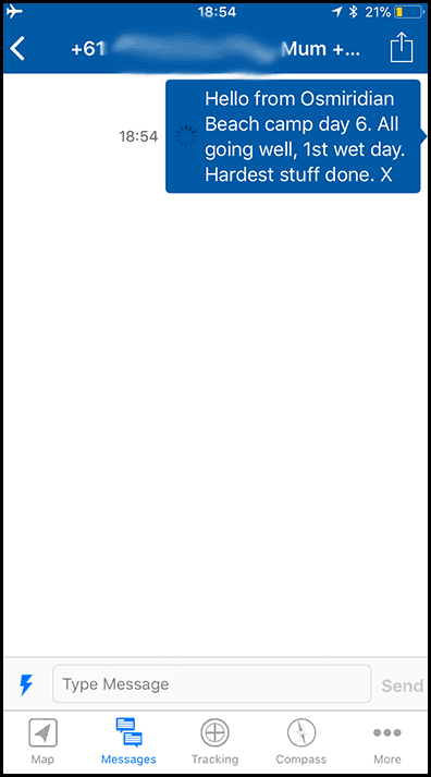
Secondary to emergency situations, it does offer peace of mind with a variety of other features. Most notably, the ability to send and receive SMS, including preset messages (which you can set up online prior to departure) which are a cheaper option.
How is that different to a SPOT Tracker?
A SPOT Tracker’s SOS button operates in the same way, but can only send preset one-way messages, along with the co-ordinates for your location. It doesn’t allow you to receive any messages back such as acknowledgement of the receipt of your call or the ETA of assistance.
User Experience
To understand the UI of the InReach is to know a bit about it’s history. This product is an update (albeit a big one) from the Delorme (circa 2011). Garmin bought Delorme in 2016 and set about bringing it into the family of Garmin products. In this current version, the menu navigation is still very much Delorme and feels quite dated. It doesn’t have the modern and streamlined experience of many of the Garmin products. The great news is that Garmin elves are working hard in the background for future models to be compatible with Oregon 7XX and Fenix devices, along with other future Garmin offerings.
Until then, the InReach is a stand alone product within the Garmin family and doesn’t integrate with Garmin maps.
Physical Experience
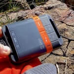
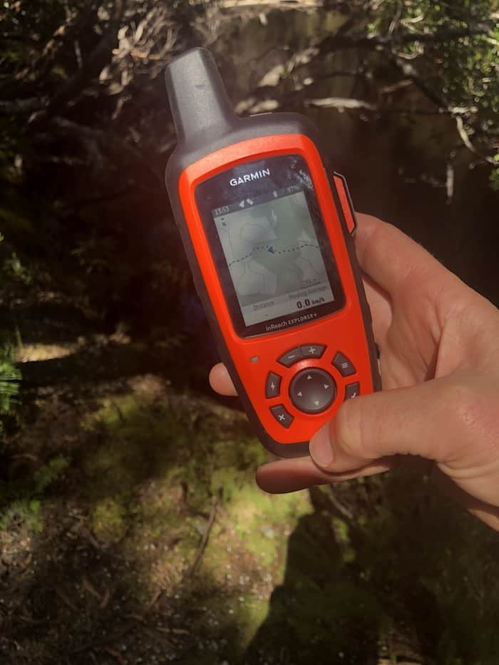
Apart from the Iridium antenna, you’d be forgiven for thinking that this is just another rugged handheld GPS device. That in itself is much nicer than the old, boxy, Delorme. Weighing in at 213 grams, it sits comfortably in the hand and comes with a handy clip and carabiner for attaching to the outside of a backpack. In fact, outside is the best place for it as it needs clear line of sight to the sky (vertical is best) to operate. Speaking of sky, it’s also water rated to IPX7 which means it’s fine with rain and snow, “showering” (why you’d want to shower with your InReach I don’t know), but not waterproof so if taking it canyoning or anywhere it might get submerged, you’ll need to put it inside a drybag or similar.
Garmin have designed the InReach, knowing that the last thing people want to do is accidentally call SOS and trigger a rescue or inadvertently have it switched on in your pack without realising it. Therefore, you need to confirm you want to turn it on (or it will switch off again) and confirm SOS before it automatically cancels it.
Battery Life
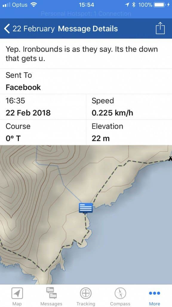
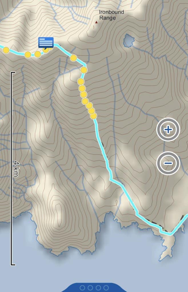
Whilst testing the device on the South Coast Track (9 days), I used it in a number of different ways. From leaving it switched on and tracking movements throughout the day on the inbuilt topographic maps (Open Street Maps come loaded), to just turning it on to send and receive messages, sending map location links to Facebook, receiving basic weather reports and then switching it off again. I was pleasantly surprised in that I didn’t need to recharge it at all and came back with it still having 65% battery, as I had elected to utilise some of the power saving functions. As it charges with a USB cable, it can easily be charged with a powerbank.
Messaging
There’s a few different ways of using the messaging with the InReach. If on a cheaper monthly plan, you’ll want to use the preset messages. You can set these up before you leave home via the Garmin website and can simply be things like, “I’m OK,” or “Running late but all good,” or “Hold my beer and watch this.”… OK, maybe not the last one. You can send unlimited preset messages on the cheapest plan. You can also send emails and bespoke SMS messages whilst in the field. The easiest way to do this is using the app EarthMate, connecting to your smartphone via Bluetooth. This way you can type and enter info with your phone keyboard, as the typing method on the InReach is the old clunky arrow-arrow-up-down-enter, to find the letters you want. I used both methods and loved EarthMate.
Navigation
It’s not surprising that Garmin chose to enclose their version of the InReach within what is essentially a GPS device housing. It looks almost identical to the Garmin 60csx style handheld GPS unit, with the orange casing a great standout in the bush.
The navigation features are a nice-to, on top of the device’s primary purpose of being a 2-way satellite communicator. In this regard it is very similar to other GPS devices where you can preset routes (prior to departure), add waypoints, tracking, digital compass and maps. It comes pre-loaded with global Open Street Maps topographic maps. The key difference with the cheaper model (InReach SE+) is it doesn’t have mapping capacity… and is yellow!
Weather Updates
A feature I found handy in Tasmania (where weather can change by the minute with extreme Antarctic/Roaring 40’s onslaughts!) was the weather forecasts. The basic weather is exactly that – a simple icon for forecast (eg. sunny, cloudy, rain, storm). On the cheap subscriptions this is the cost of 1 SMS message and you can elect for premium weather (which includes marine) for $1.50 AUD per forecast.

Setup time
If you decide to use an InReach, my biggest piece of advice is to make sure you allow yourself at least an hour (two would be better) to do the full setup and test before you leave home. There are detailed instructions (I found YouTube videos from users more helpful) and quite a few hoops to jump through. Setup includes adding in your contacts, testing the satellite connection, setting up preset messages, adding in routes (if using), plus a few other bits and bobs to make sure that you’re fully functional. It’s worth putting in this investment in time.
Garmin InReach Cost
One of the downsides of devices like the InReach (and SPOT Tracker) is that there are two costs involved. Firstly, buying the device (LINK) and then a monthly subscription cost. PLBs are a one-off cost only.
There are a variety of monthly plans available in Australia, and as at April 2018 the cheapest is $20/month (based on annual subscription) or if you’re using it for one-off adventures in remote areas, the $25/month (minimum 30 day plan) is a good choice. There’s a few additional costs also, so be sure to read the fine print.
Plans : https://explore.garmin.com/en-AU/inreach/

Summary
With the InReach, it feels like Garmin is trying to create one device to rule them all and sure, it is packed with a stack of features that are handy to have on top of the emergency essentials. It is the standout leader when it comes to 2-way satellite communication. It promises:
- Comms: Two way satellite comms, SOS, SMS, email, Facebook (1-way)
- Navigation: GPS Digital maps built in (Explorer+ model only), compass, tracking
- Weather updates
I feel it is excellent at communications, handy with the weather, but feel that the navigation elements are functional, as for me personally, I prefer a bigger screen of a smartphone navigation app with higher resolution maps.
I’d definitely carry it as my primary communications and SOS device.
For a more in depth, technical review, I can recommend: https://hikingguy.com/hiking-gear/in-depth-garmin-inreach-explorer-review/
You can visit Garmin InReach for more information.