
Romer
$8.95
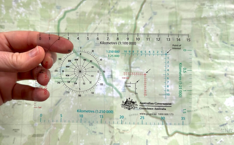
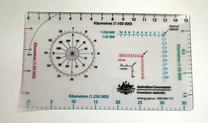
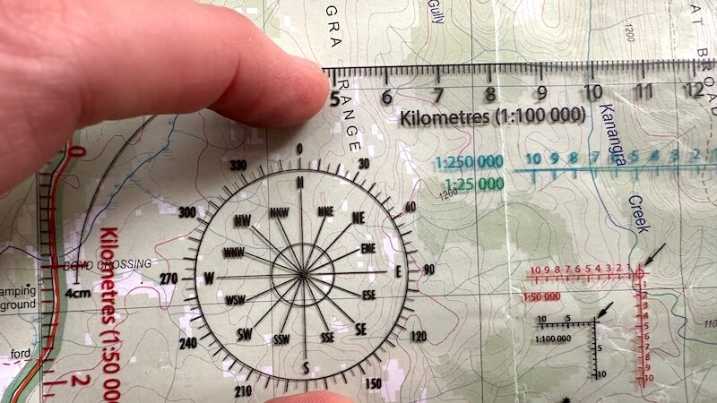
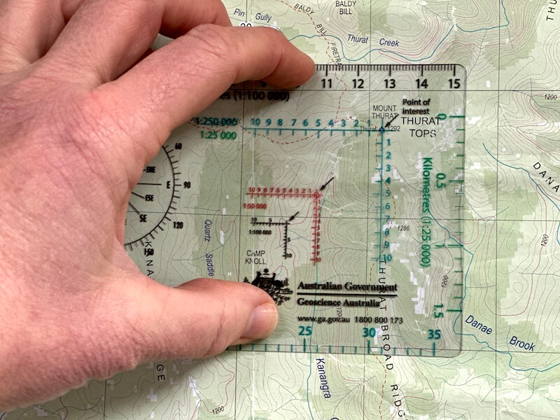
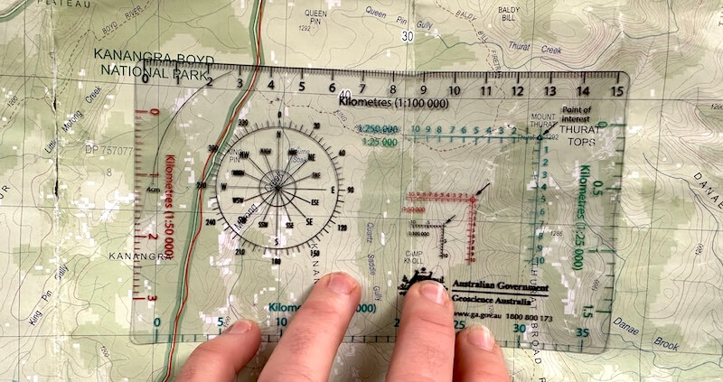
A romer is a navigational tool used for accurately determining grid references on a map. It's a transparent plastic card with markings that align with map scales and grid lines, allowing you to pinpoint precise locations on a map.
This official Geoscience Australia romer has scales in 1:25,000, 1:50,000, 1:100,000 and 1:250,000.
It also includes a protractor for measuring angles which is handy when double checking your compass bearing. My video below explains how.

Available on backorder
Wendy (verified owner) –
So useful! Will be ordering more!
Caro Ryan (store manager) –
Good to hear, Wendy. They can be tricky to get your hands on… stay tuned – I have some updates on these coming soon :).
Tony Costa (verified owner) –
Rodney G. (verified owner) –
Liam (verified owner) –
Mike Fuery (verified owner) –
One of those very useful ‘tools of trade’ for navigating that are always good to have on hand. And how great it is to be able to get it from the one who taught me how to use them. Thanks Caro!!!
Peter Collison (verified owner) –
Alan Holley (verified owner) –
I will need to be sure not to lose the thing
Caro Ryan (store manager) –
I keep mine in my map case for this exact reason. Another idea would be to add a small bit of flouro tape to one of the corners without text on it, so that it would show up if it’s on the ground.
Paul (verified owner) –
Robyn K. (verified owner) –
Anonymous (verified owner) –
Anonymous (verified owner) –
Dani Fewster (verified owner) –
Colin (verified owner) –
Bruce (verified owner) –
Just arrived yesterday and still reading about how to use all the features.
Caro Ryan (store manager) –
There’s many ways to skin a cat AND use a romer. I am planning a how-to video for them.
David Y. (verified owner) –
Thinner than expected.
Caro Ryan (store manager) –
Interesting to hear you say that, David. This is the romer that I source from Geoscience Australia and I’m keen to know if anything in my product description led you to feel this way, as I want to make sure nothing is misleading or confusing. Let me know so I can address it. Thanks!
Simon S. (verified owner) –
Yep – all good. Ordered product and it arrived in a timely manner and in good condition
Caro Ryan (store manager) –
I try my best, Simon! 😉
Phil Watson (verified owner) –
Practical and sturdy product with excellent service.
Caro Ryan (store manager) –
Good to hear, Phil. Thanks for letting me know.
Anonymous (verified owner) –
kenneth graham wilkinson (verified owner) –
Great device
Cordell Kent (verified owner) –
Excellent
Ron Dunford (verified owner) –
Peter M. (verified owner) –
First class romer. Very happy indeed. Delivery was very quick too.
Caro Ryan (store manager) –
Great to hear
Peter (verified owner) –
Peter W. (verified owner) –
Great product and delivered promptly
Caro Ryan (store manager) –
Thanks Peter!
Qynn (verified owner) –
Grant Pingo (verified owner) –
Jarrah Keenan (verified owner) –
exactly what I needed! good price and fast delivery
Caro Ryan (store manager) –
Ticking all the boxes, Jarrah! Thanks for letting me know.
Desmond R. (verified owner) –
A tool I’ve never had before!
Kieran Hosty (verified owner) –
Perfect for what we wanted.
Caro Ryan (store manager) –
Good to hear. Makes taking grid references easier and more accurate.
Adam (verified owner) –
High quality detailed book and compass lanyard / Scale. Arrived very quick as well , I’m happy with the product. It is worth the purchase!
Samuel (verified owner) –